Rijnkaai Zuid (en)
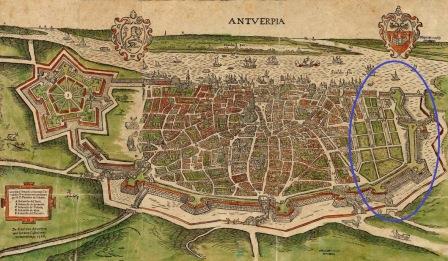
A tram line will be built which runs from Eilandje to the city centre as part of the Noorderlijn-Brabo 2 project. This will cut through the underground remnants of the Spanish ramparts, the historic harbour inlets and dwellings:
- Rijnkaai: wall of the Bastion of Kattenberg and Timmervliet
- Tavernierkaai: Graanvliet and the sixteenth-century dwellings of Nieuwstad
- Rouaanse kaai: filled in Brouwersvliet and a demolished medieval building block
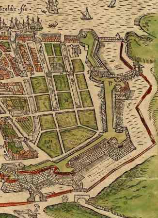
Vlieten, as they are called in Dutch, were harbour inlets that connected the city with the Scheldt, enabling ships to unload goods in the city. In the sixteenth century, three inlets were dug as part of the northern city expansion or Nieuwstad, namely Timmervliet, Middelvliet or Graanvliet and Brouwersvliet. Brouwersvliet (axis of Oude Leeuwenrui-Ankerrui) was built before this and served as the boundary of the medieval city around 1400.
The quays looked quite different as a result of the wharves and harbour inlets. Under Napoleon’s reign, the city walls along the quays were demolished. Following the construction of Willem Dock, situated in between Graanvliet and Timmervliet, these inlets were no longer connected with the river. At the end of the nineteenth century, the Scheldt quays were realigned and the inlets filled in.
The quay walls of these inlets are probably still preserved largely intact underground.
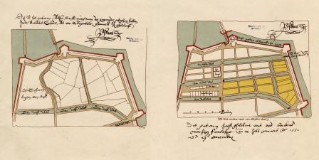
The works will also cut through the historic building blocks that were demolished in the nineteenth century for the construction of the new quay zone.
The archaeological survey will map all these remnants and survey them. Where possible, the ramparts will be made visible again in the new street designs.