English Quay/Pilotage building
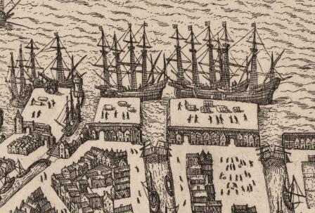
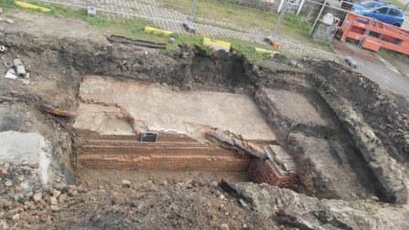
From the fifteenth century to until around 1550, the medieval city was enclosed by a moat, called Brouwersvliet. Following the construction of a new city wall by Emperor Charles V, the moat was located between the city and the northern city expansion, called Nieuwstad – where dozens of breweries were subsequently established. Brouwersvliet connected to the River Scheldt and was located between the English Quay and Meekaai quay.
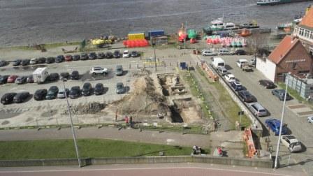
The northern quay wall of Brouwersvliet was not found during the survey, probably because the wall is situated just outside of the test pit. The southern quay wall of Brouwersvliet was found near a quay called Rouaanse Kaai.
GISid:
076
Afbeelding:

Latitude:
51.23
Longitude:
4.40
Meer info: