Londen-/Amsterdamstreet
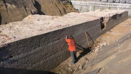
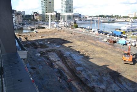
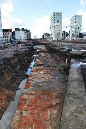
The builders uncovered the city wall in various locations when rebuilding Londenstraat and Amsterdamstraat. This is a straight section of wall (courtine) between the Kattenberg, Slijkpoort and Noorderplaats bastions. This wall has a sixteenth-century brick core. The front of the wall is clad with alternating stone bands of brick and natural stone called speklagen (bacon layers). This renovation was carried out in the northern part of the city wall under Napoleon’s reign in the early nineteenth century. Remnants of the city wall will be surveyed again during the works for the construction of a tram line in the frame of the Noorderlijn project.
GISid:
072
Afbeelding:


Latitude:
51.23
Longitude:
4.41
Meer info: