Rijnkaai South
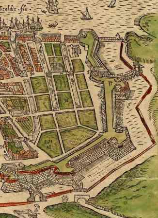
During the works on the tram line along the quays in the section that runs from Amsterdamstraat in the north to St-Pietersvliet in the south, archaeological structures were uncovered. The walls of the Bastion of Kattenberg and the former Timmervliet run underground in Rijnkaai, in the section from Amsterdamstraat to St-Laureiskaai.
There are still remnants of Graanvliet and the sixteenth-century houses of Nieuwstad under Tavernierkaai. In Van Meterenkaai the new structures run through the filled in Brouwersvliet and demolished medieval dwellings. All these remnants will be subjected to an archaeological survey and measured during the works.
GISid:
072
Afbeelding:
Latitude:
51.23
Longitude:
4.40
Meer info: