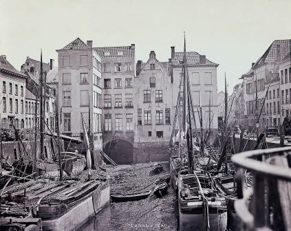
Sint-Jansvliet (en)
In the early Middle Ages, Sint-Jansvliet was a natural inlet or channel. As of 1200, the inlet was part of the city. It was widened so boats could moor side by side. This was not possible elsewhere in the city. Over time, various markets were organised on either side of this inlet, such as the fruit market and the flax market.
Sint-Janspoort Gate was situated at the junction of Hoogstraat and the inlet. This southern gateway to the city included a bridge across the inlet. Not many plans and drawings have been preserved because the gate was already demolished in 1581.
GISid:
073
Afbeelding:

Latitude:
51.22
Longitude:
4.40
Meer info: